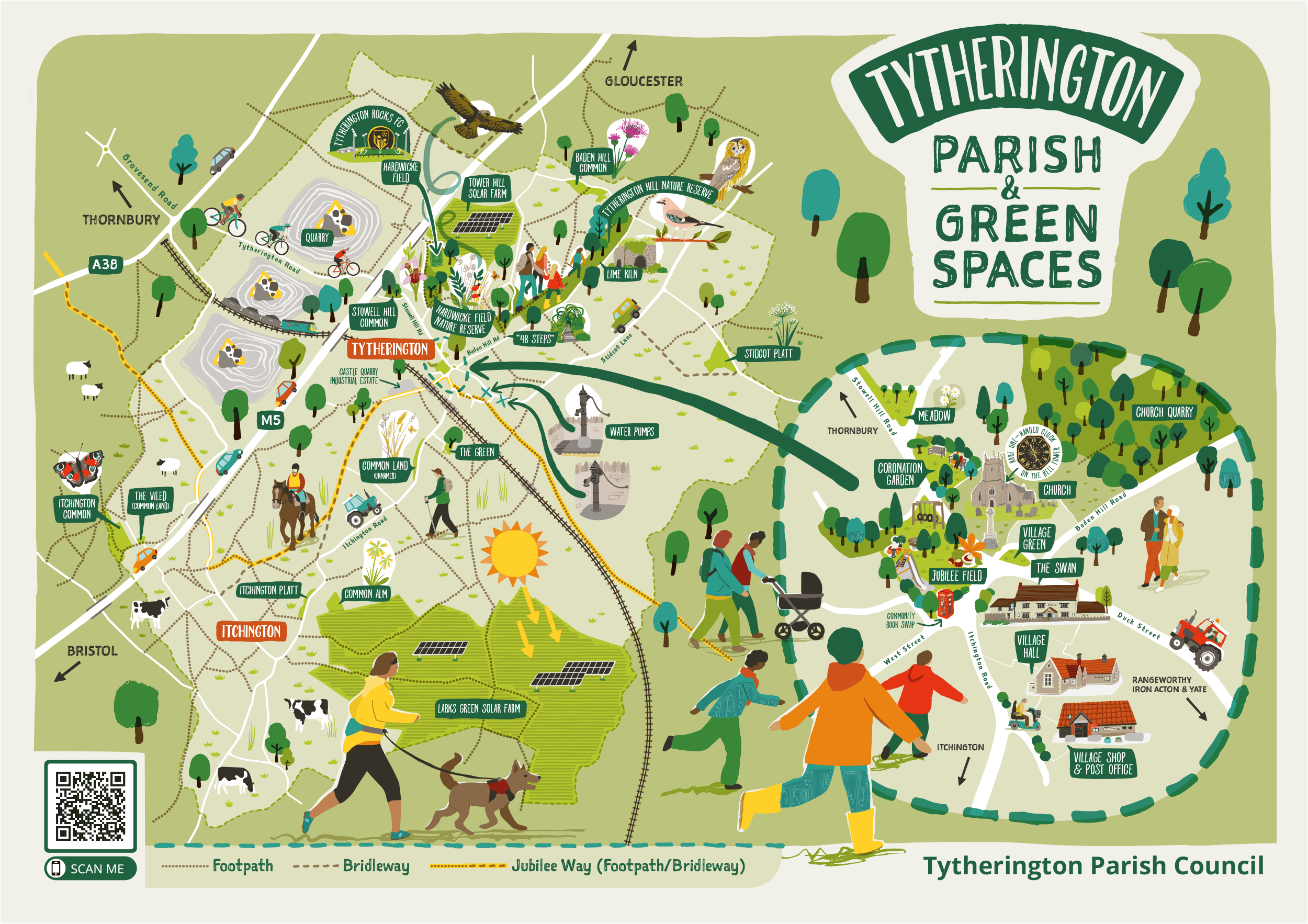
PROJECT: TYTHERINGTON GREEN SPACES
CLIENT: TYTHERINGTON PARISH COUNCIL
Tytherington is a rural village in South Gloucestershire - A close-knit and growing community of around 600+ residents, with a Parish Council of 5 councillors.
There has always been a strong walking culture within the village, and the Council are keen to build on this and encourage further use of community outdoor spaces, walking routes and general enjoyment of local countryside and nature.
OBJECTIVE
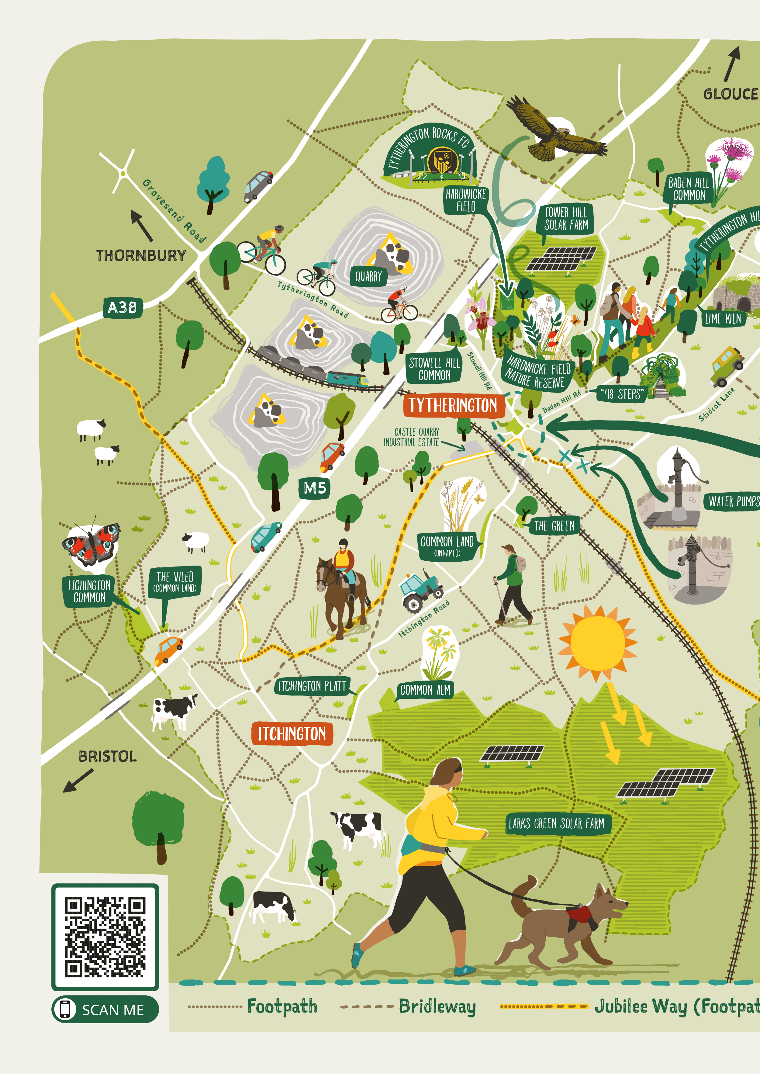
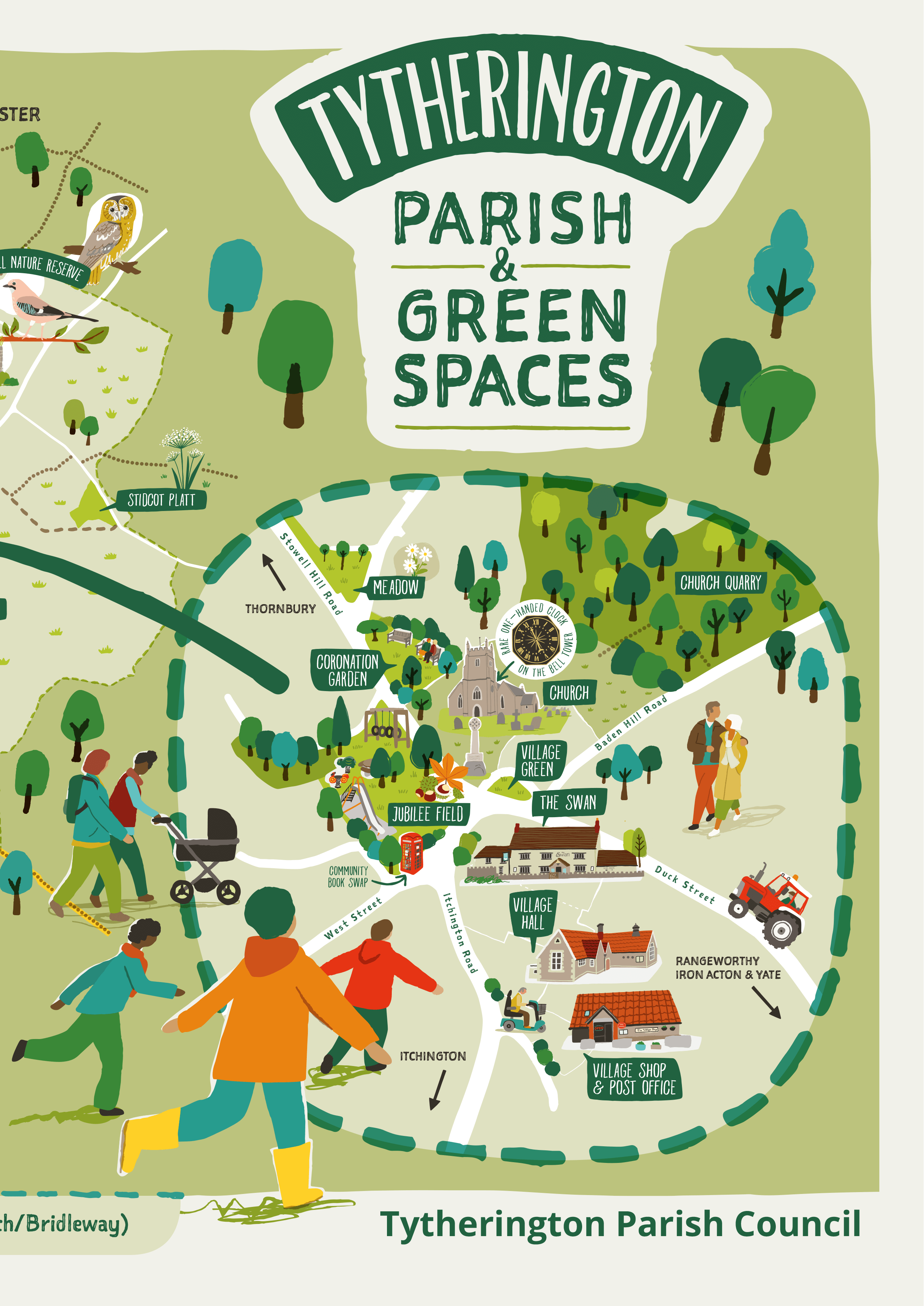
To create an illustrated map of Tytherington’s public open spaces and commons, featuring the large number of Public Rights of Way that run through the area (there are around 30!), and give a sense of what can be found locally in terms of nature, a play area, a sports pitch etc
The purpose of the map is to ensure local residents, and particularly those moving into the area, are aware of how accessible the countryside around them is - to inform of local walking routes and rights of way and generally encourage the idea of getting outdoors to explore and enjoy nature.
The map will be printed as a large scale board, to be located in the central play area of the village and also featured on the Biodiversity page of the Parish Council’s website here
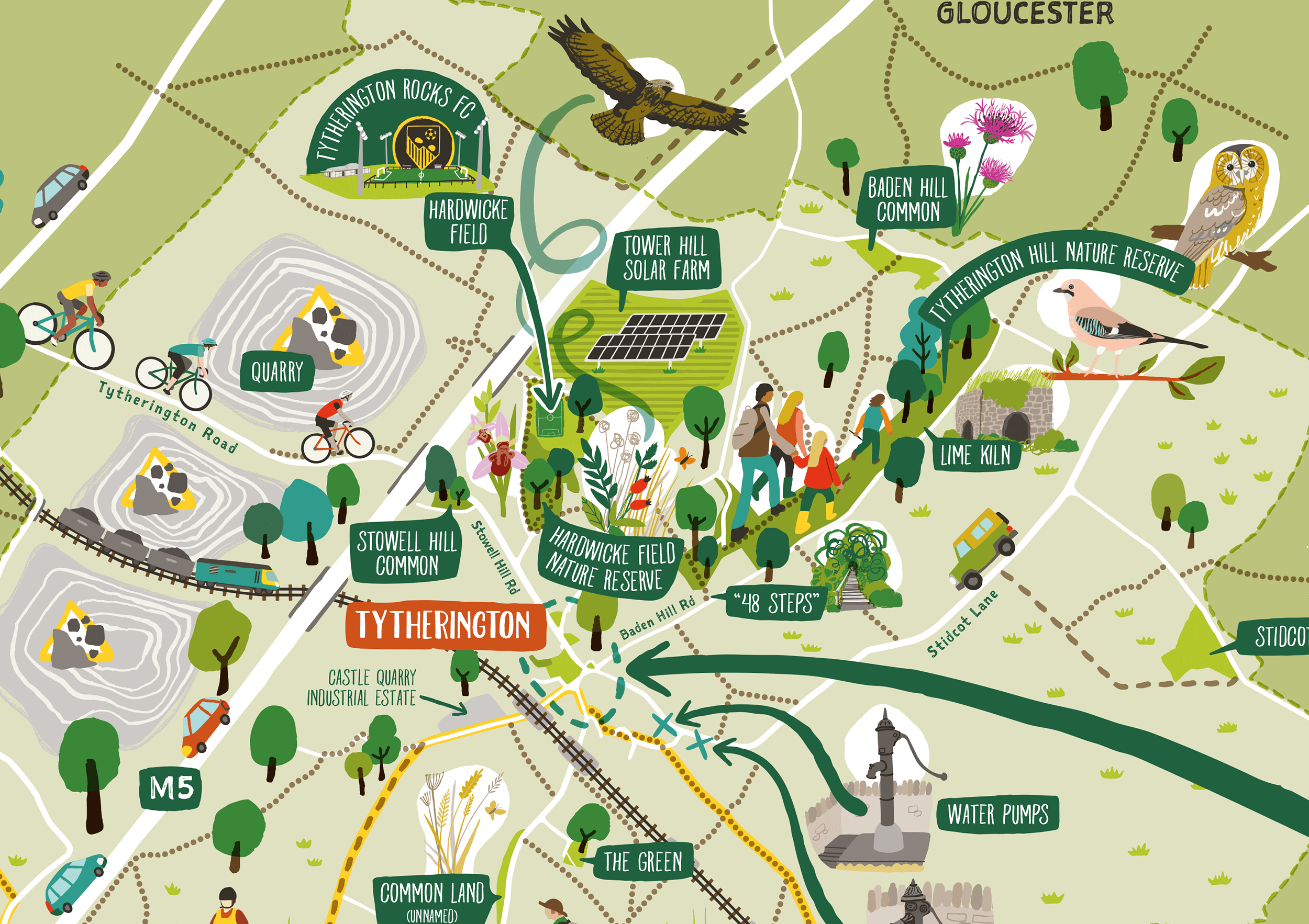
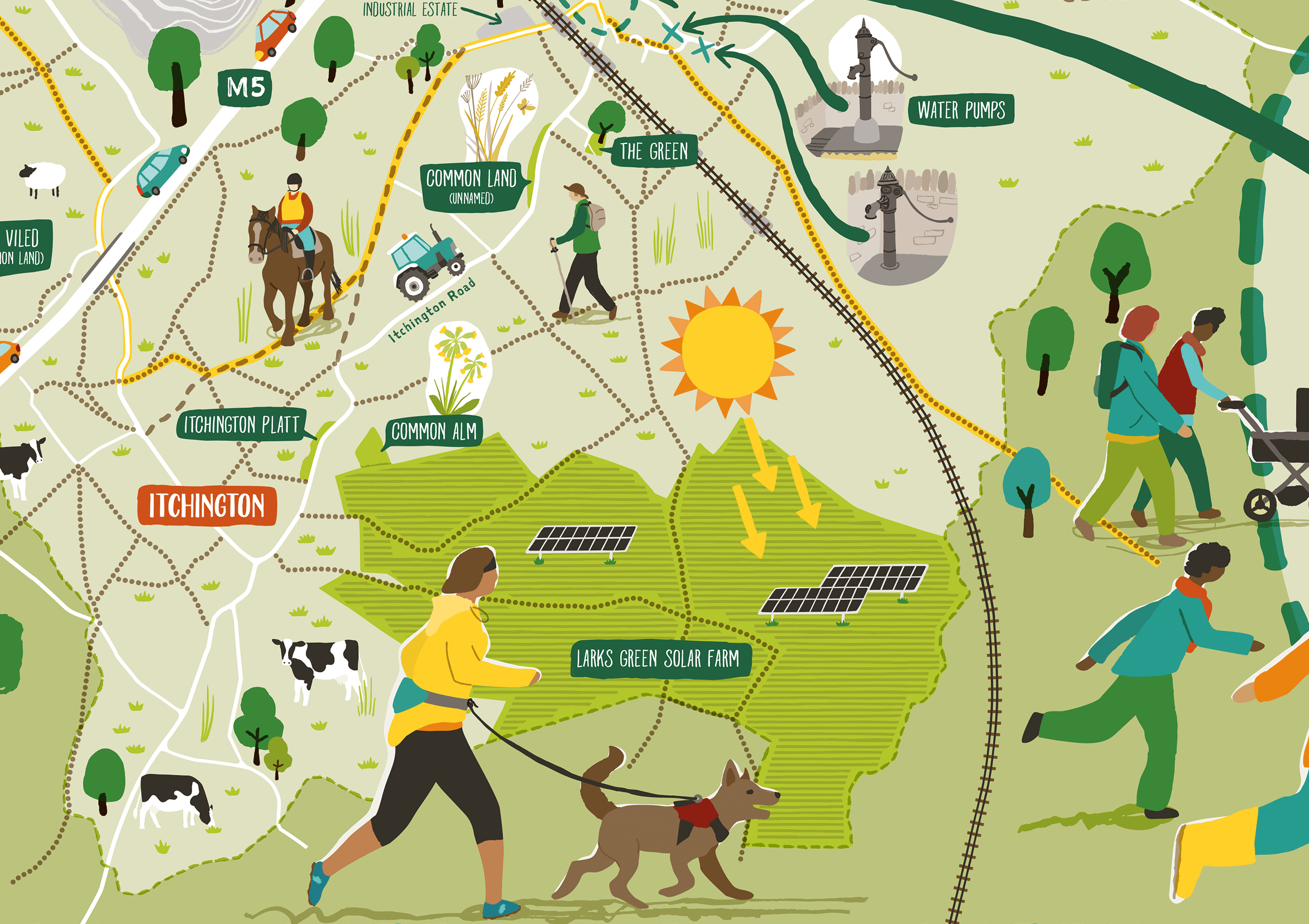
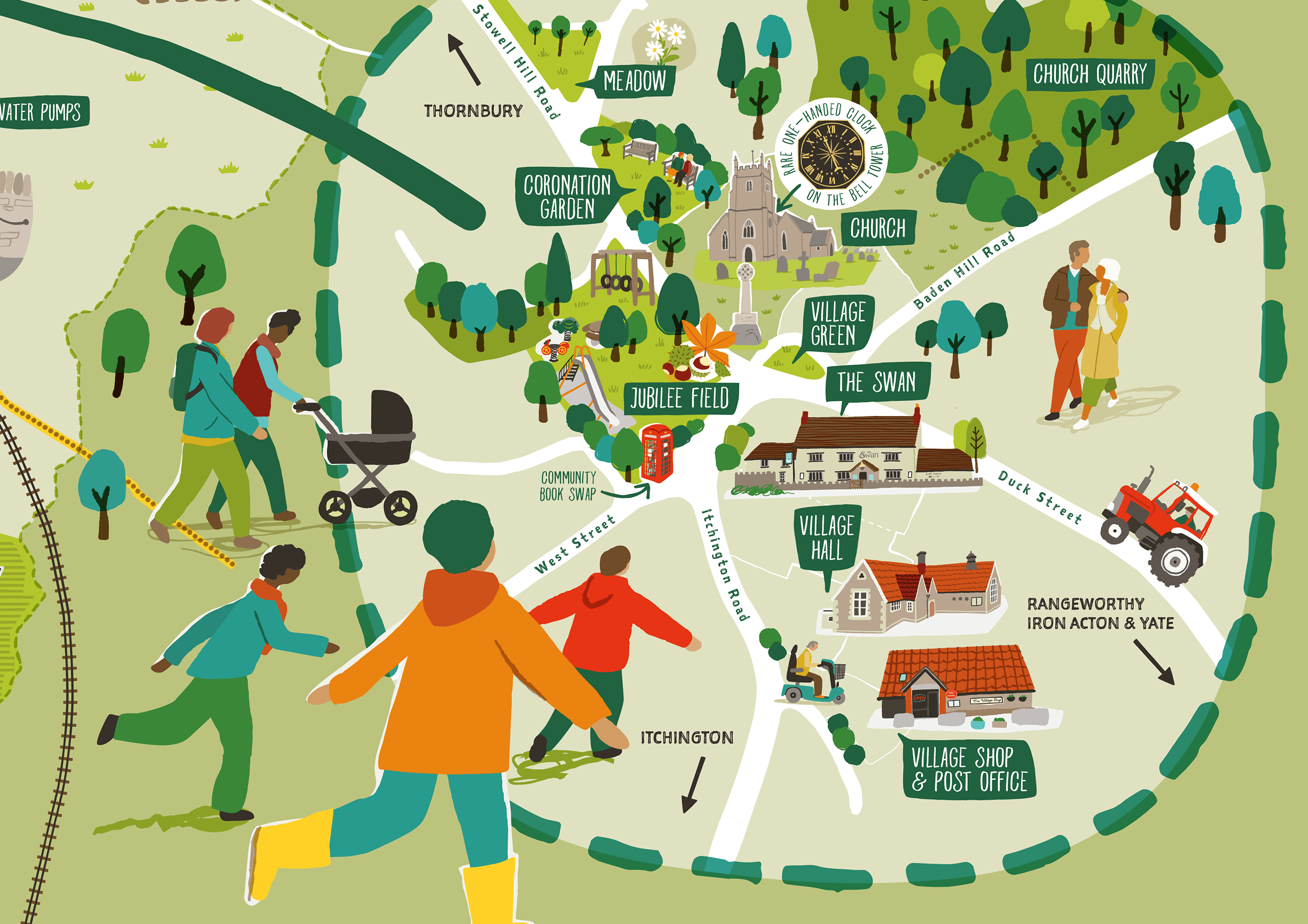
Some close-ups….
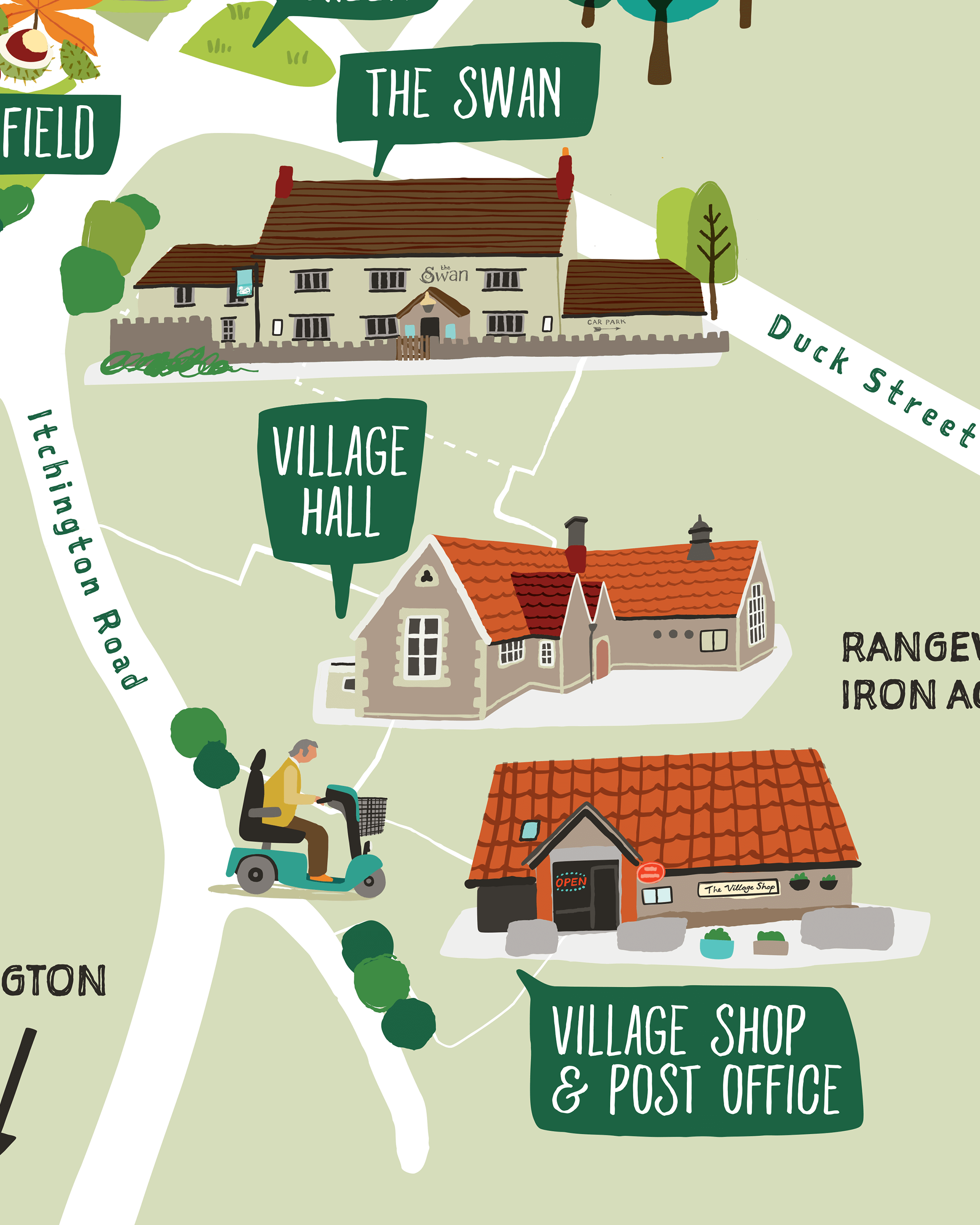
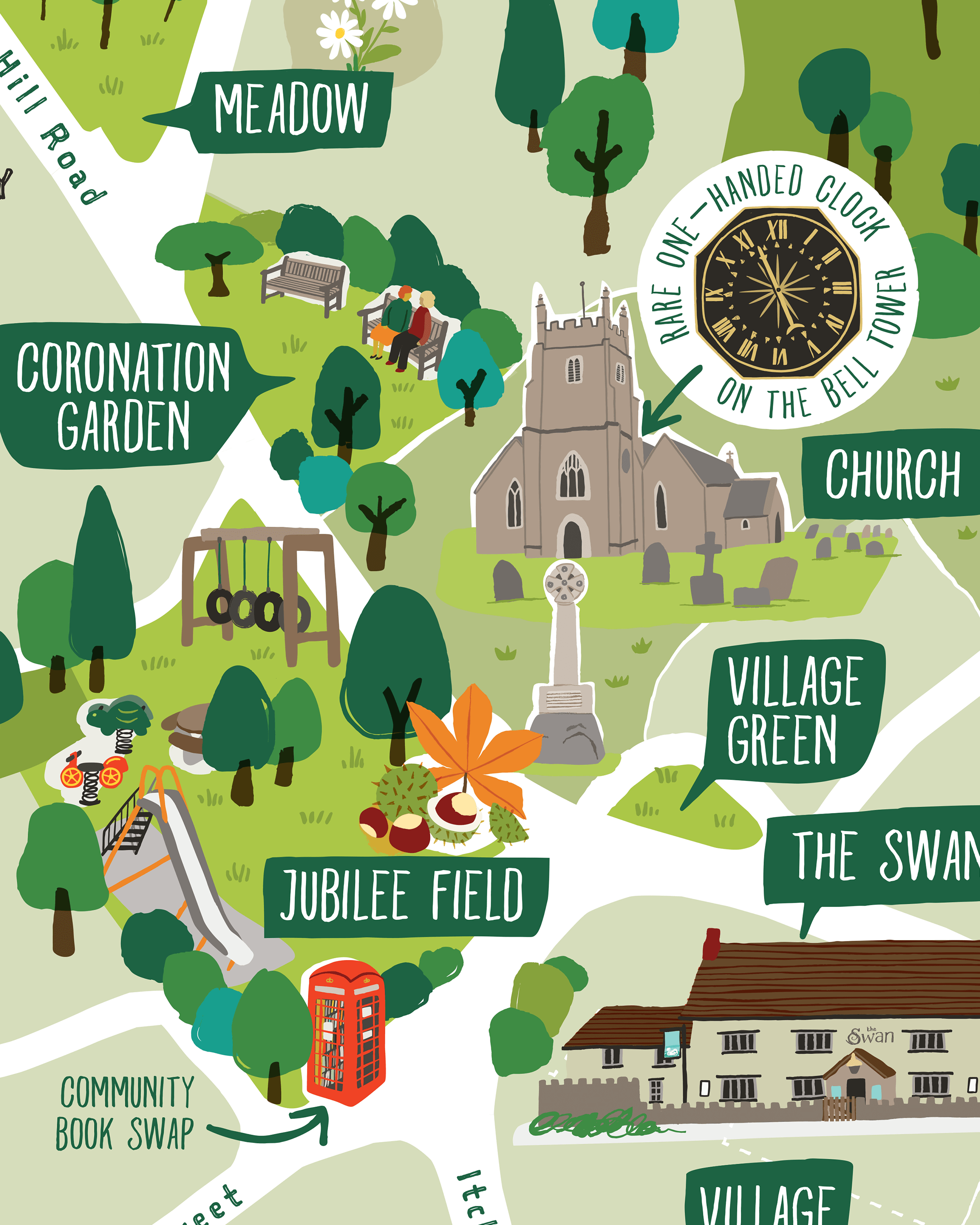
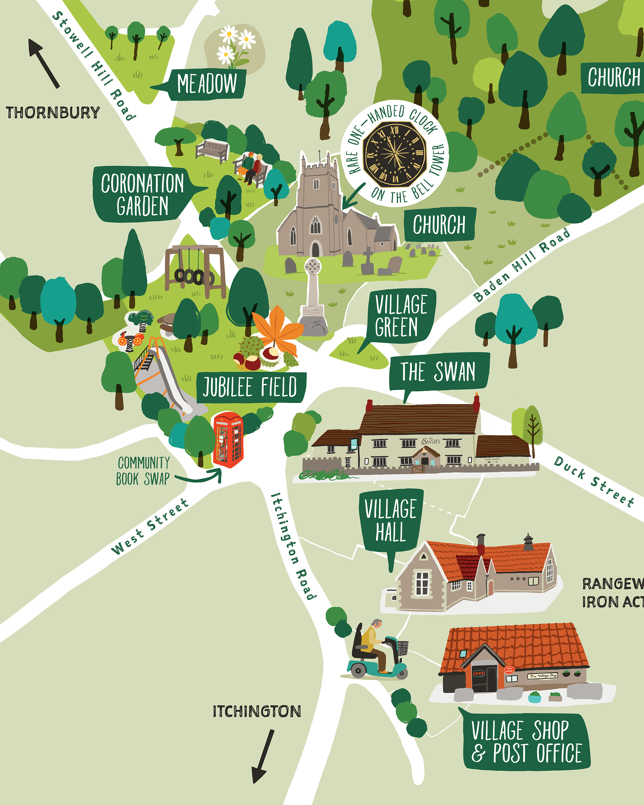
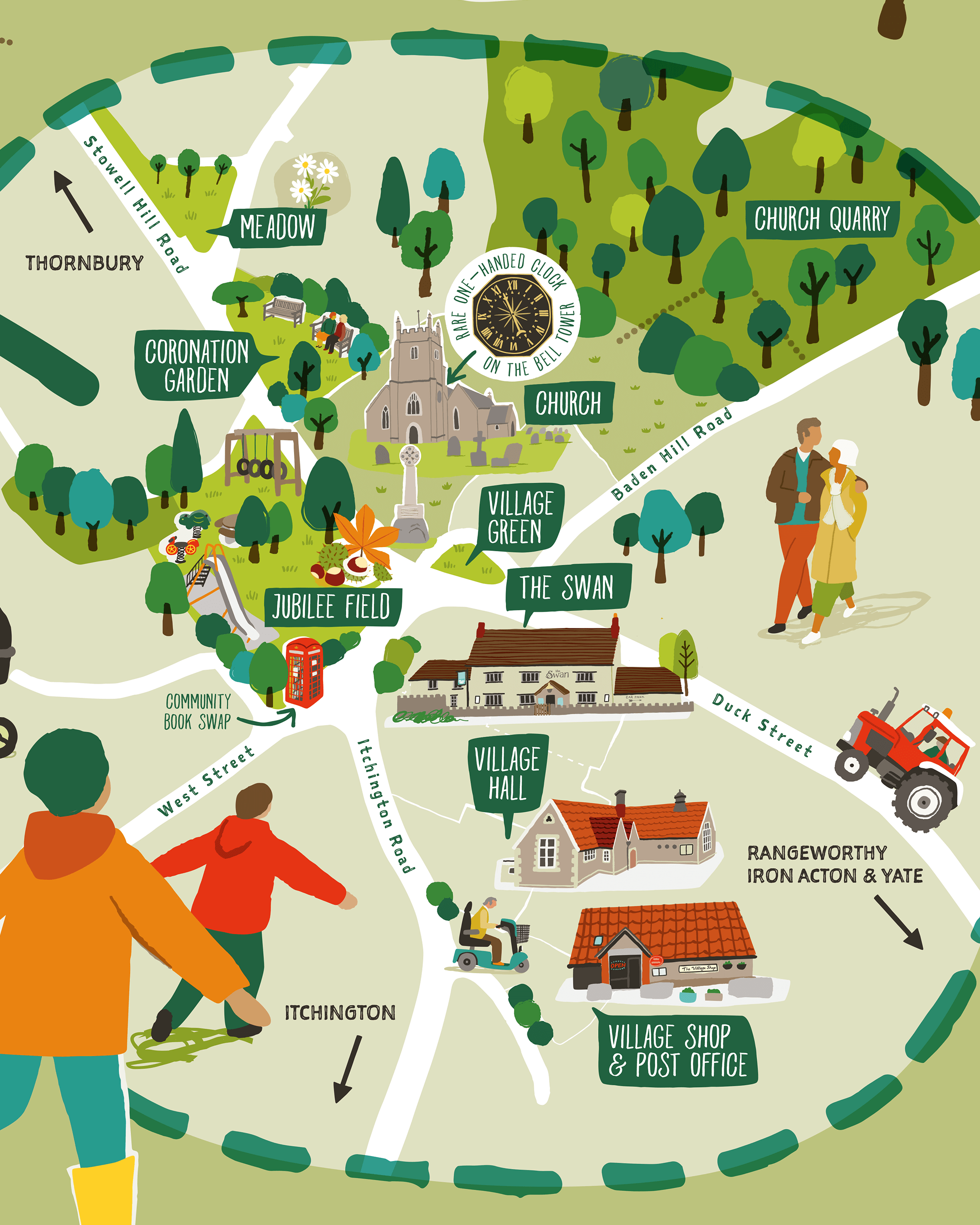
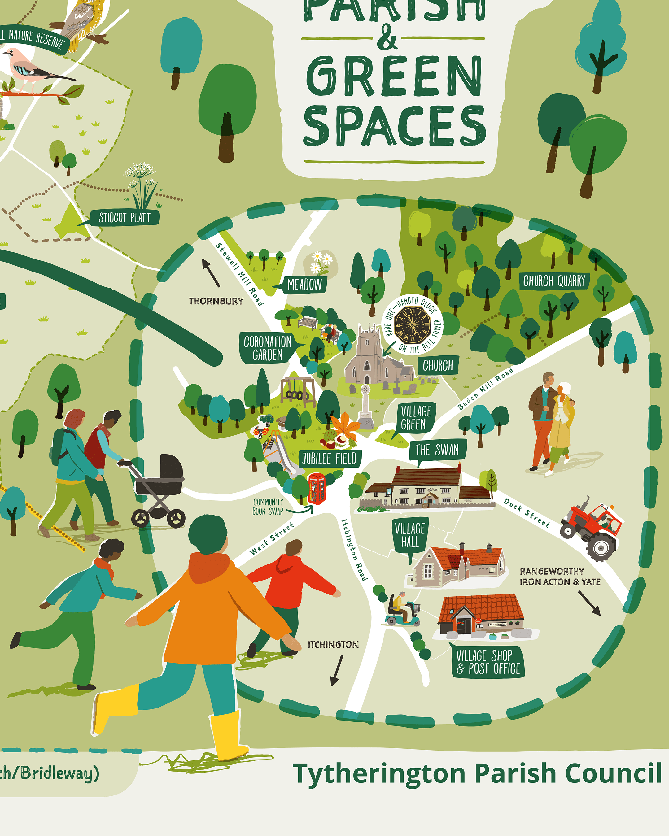
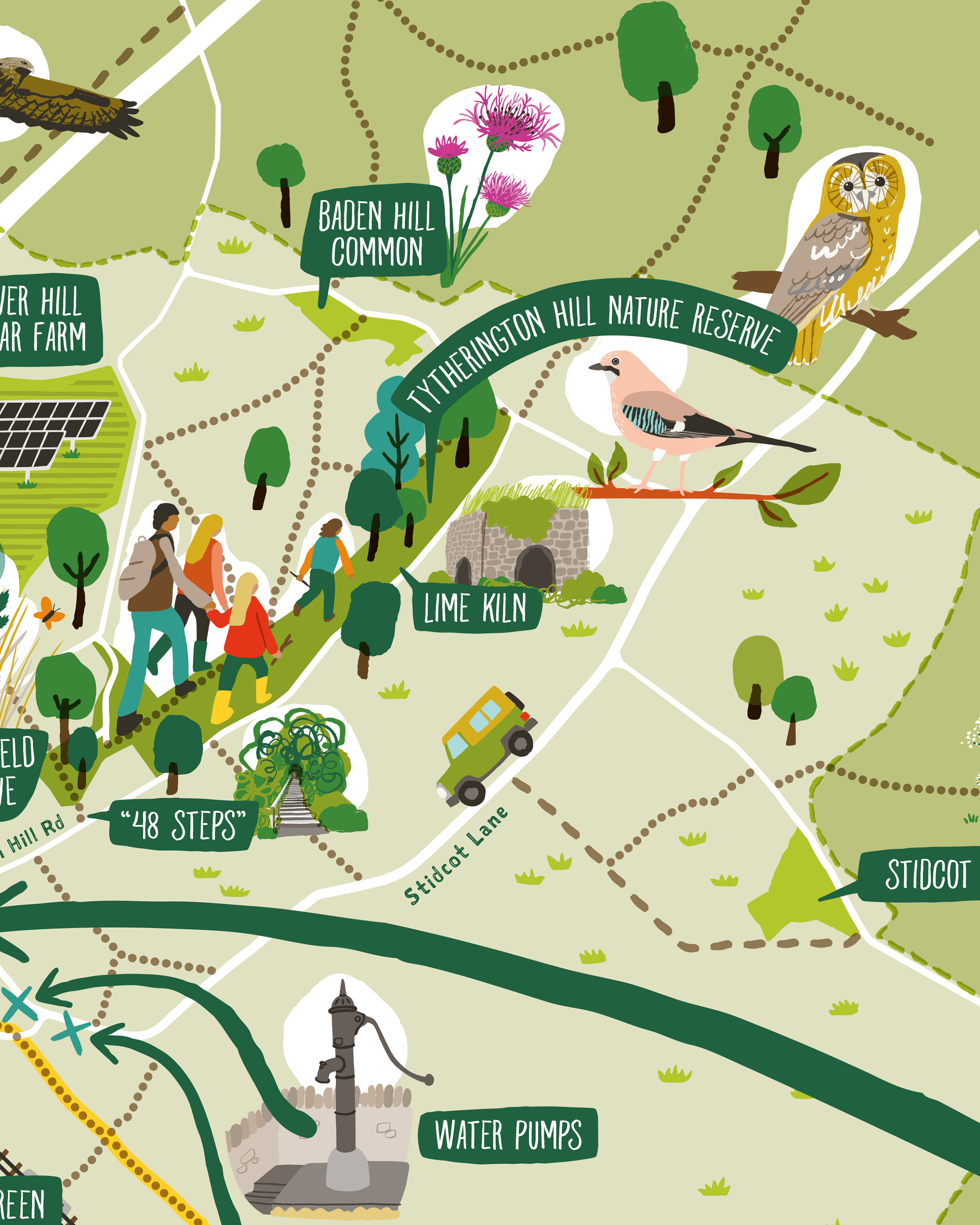
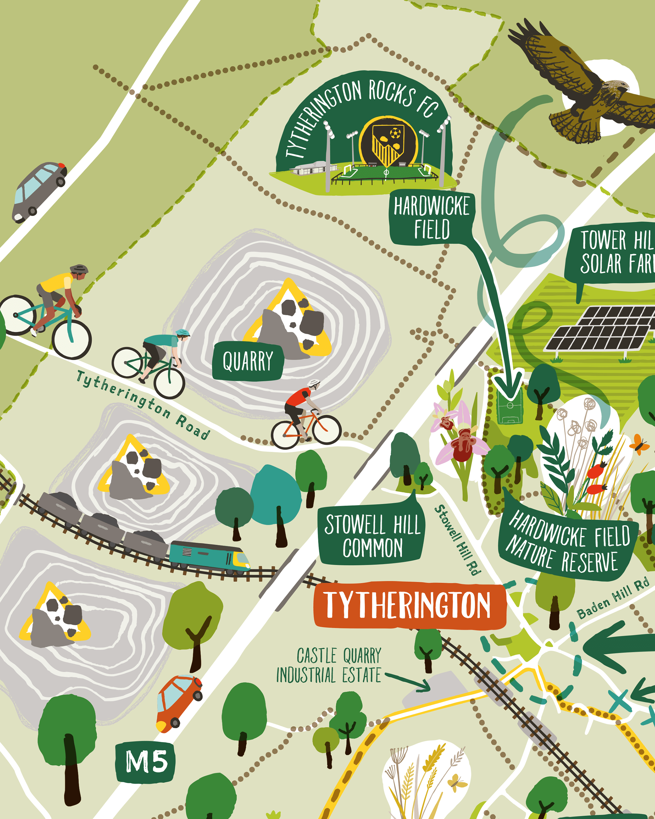
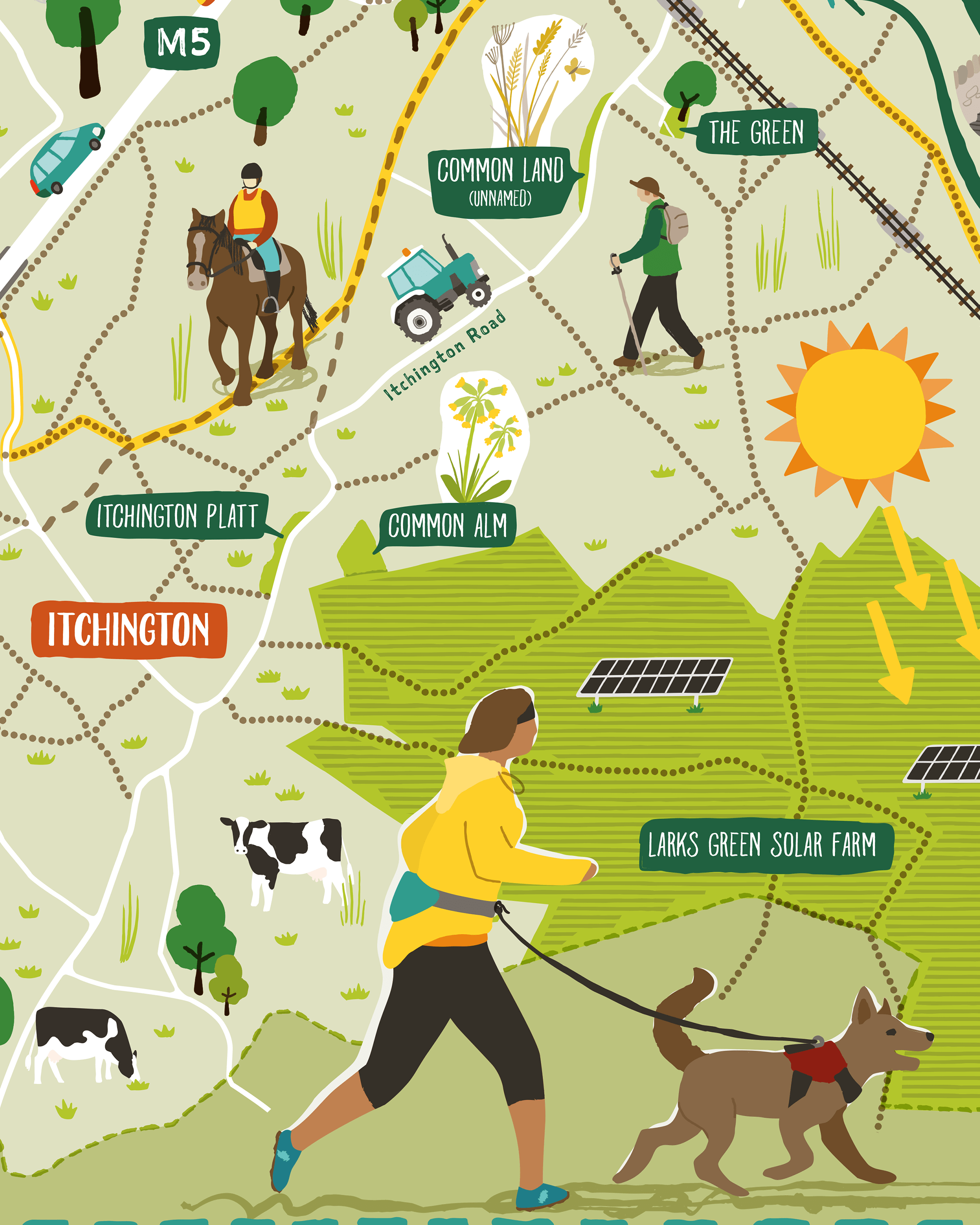
The style of the map is intended to be fun and engaging with an appeal for children and families as well as older residents, with lots of details to spot! Although highly simplified in terms of geography, the public rights of way are all accurately plotted.
PROCESS
As with all map projects I work on, my process involves drawing out a base map and then sketching the illustrated elements to be included and positioning them over the map.
In this instance there were 2 maps - the village and the wider area - to combine into one overall layout, and then populate with a few people and activities. These sketches were shown to the client for approval before I progressed onto working up the final artwork.

Tytherington village, with sketches of featured elements to be included

The wider area of Tytherington Parish, with sketched feature elements
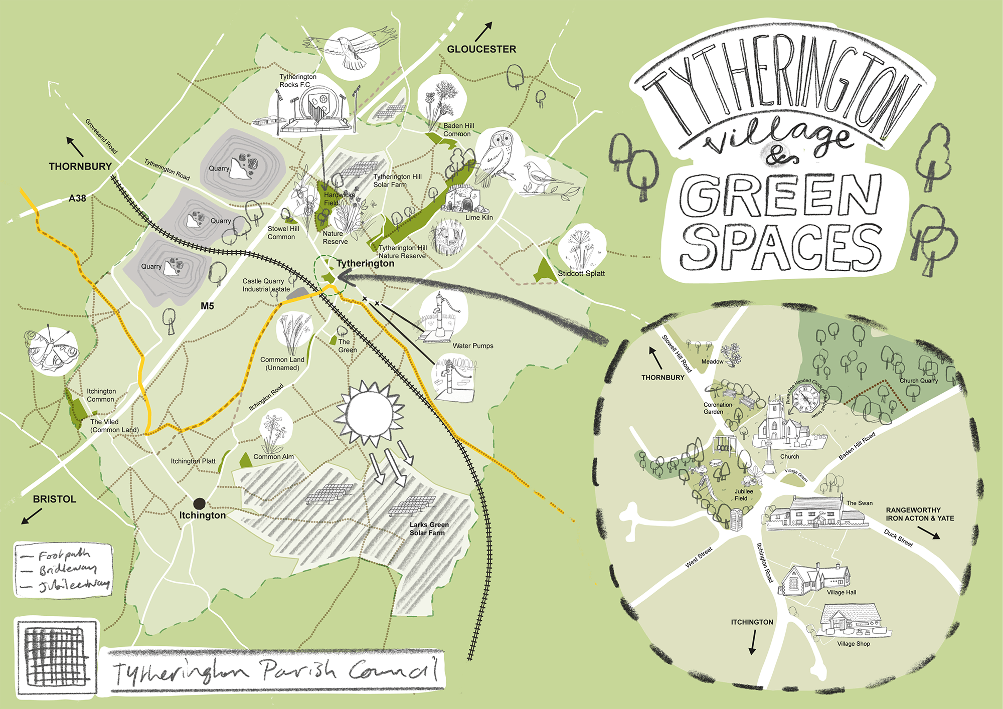
The 2 maps combined into 1 layout, with space for the title design

….And populated with people enjoying the outdoors!
RELATED PROJECTS

CELEBRATING FILTON | Illustrated map of Filton, North Bristol, connecting together the various amenities available locally

SOUTH KEN GREEN TRAIL | Logo & Illustrated trail map for Discover South Kensington