
PROJECT: ILLUSTRATED SITE MAP
CLIENT: CLAAS UK
CLAAS UK are responsible for the distribution and support of CLAAS products in the UK, Ireland, the Channel Islands and Isle of Man. They are a global agricultural machinery manufacturer - although no machines are actually made in the UK, here they are an import business.
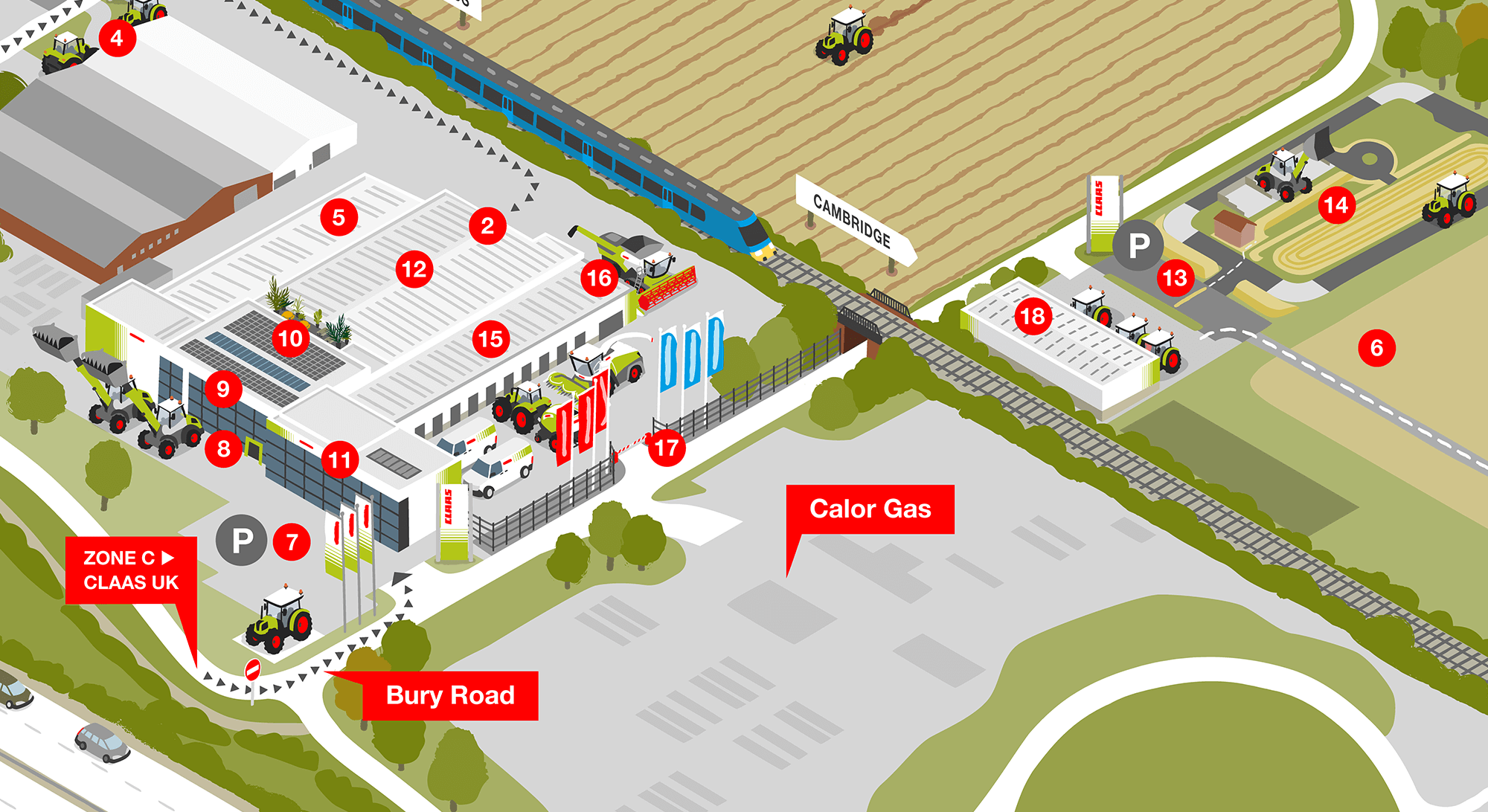
The CLAAS UK headquarters is in Saxham, Suffolk. It is quite an extensive site covering 20 acres, in a rural setting.
OBJECTIVE
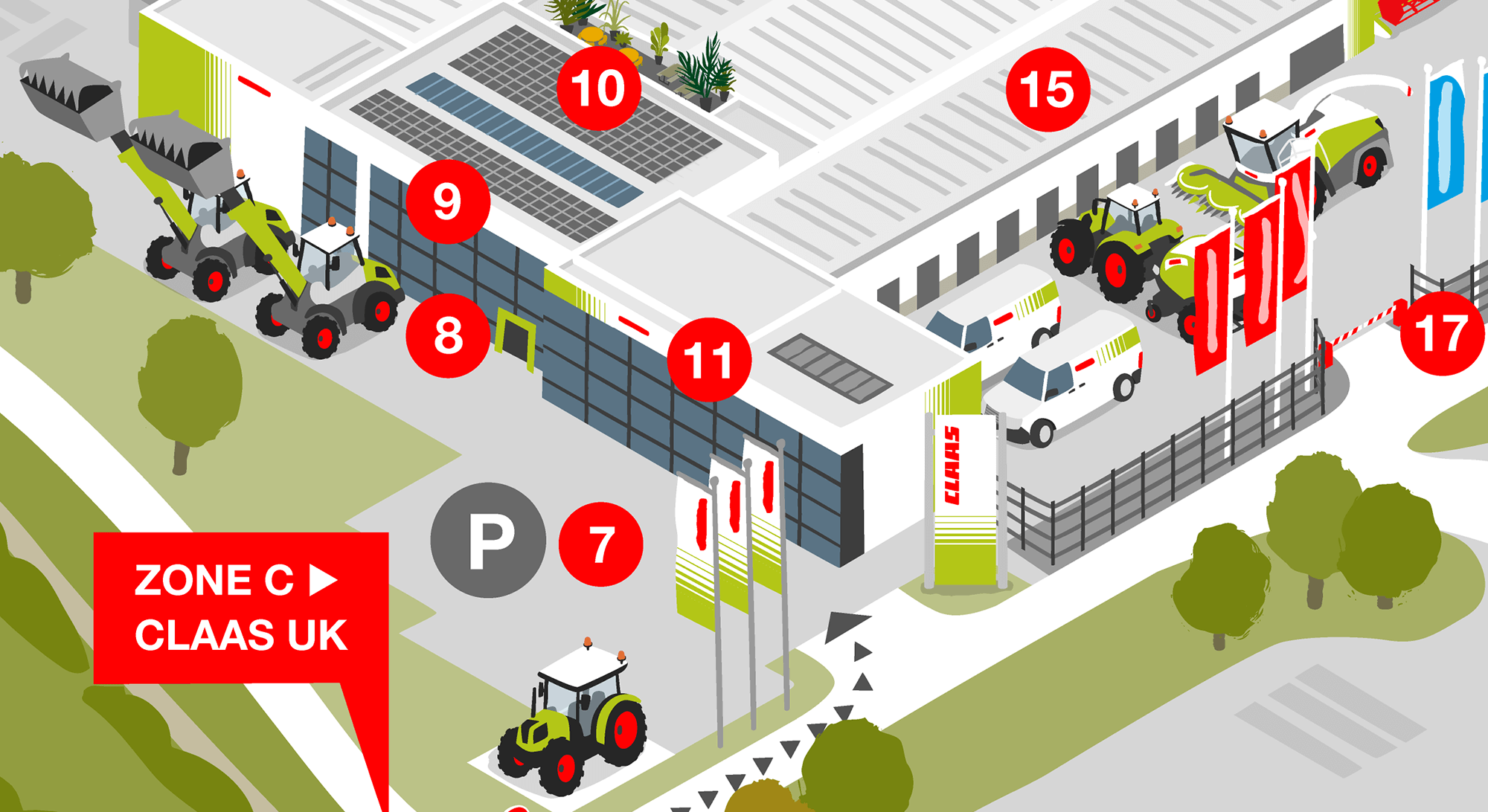
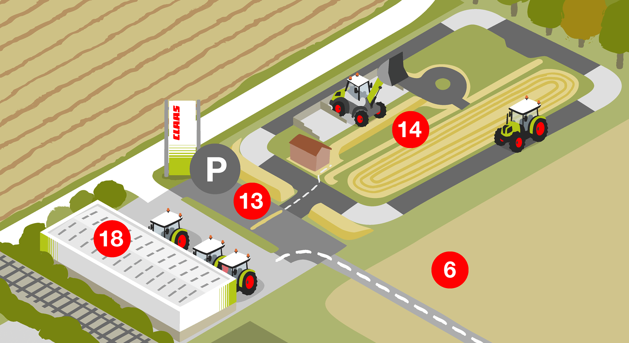
To create a clean, modern map of the CLAAS UK headquarters, to tie in with the CLAAS brand which has quite a minimalist feel. The map was to include the various company buildings and facilities along with a range of CLAAS machinery and is intended to help visitors understand the layout of the site, and where specific areas are located.
The CLAAS machines are extremely sophisticated, and use state of the art technology - I was asked to reflect this and also to incorporate a more personal feel, which would be in keeping with the fact they are a very people-focussed business.
The map is for digital and online use, and is also to be displayed as a large scale print in the main reception area.
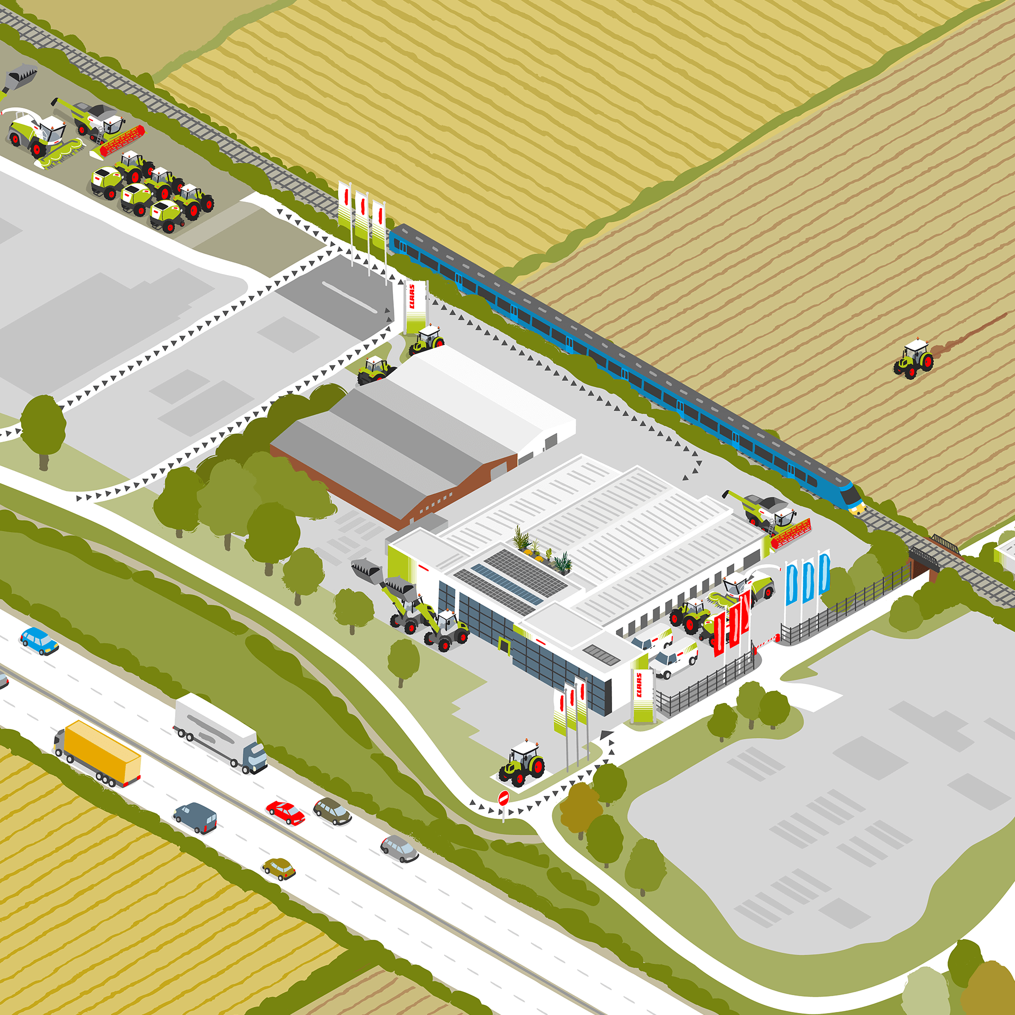
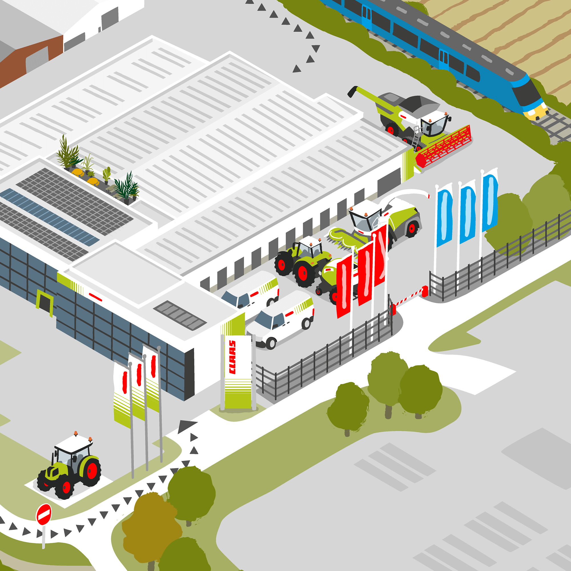
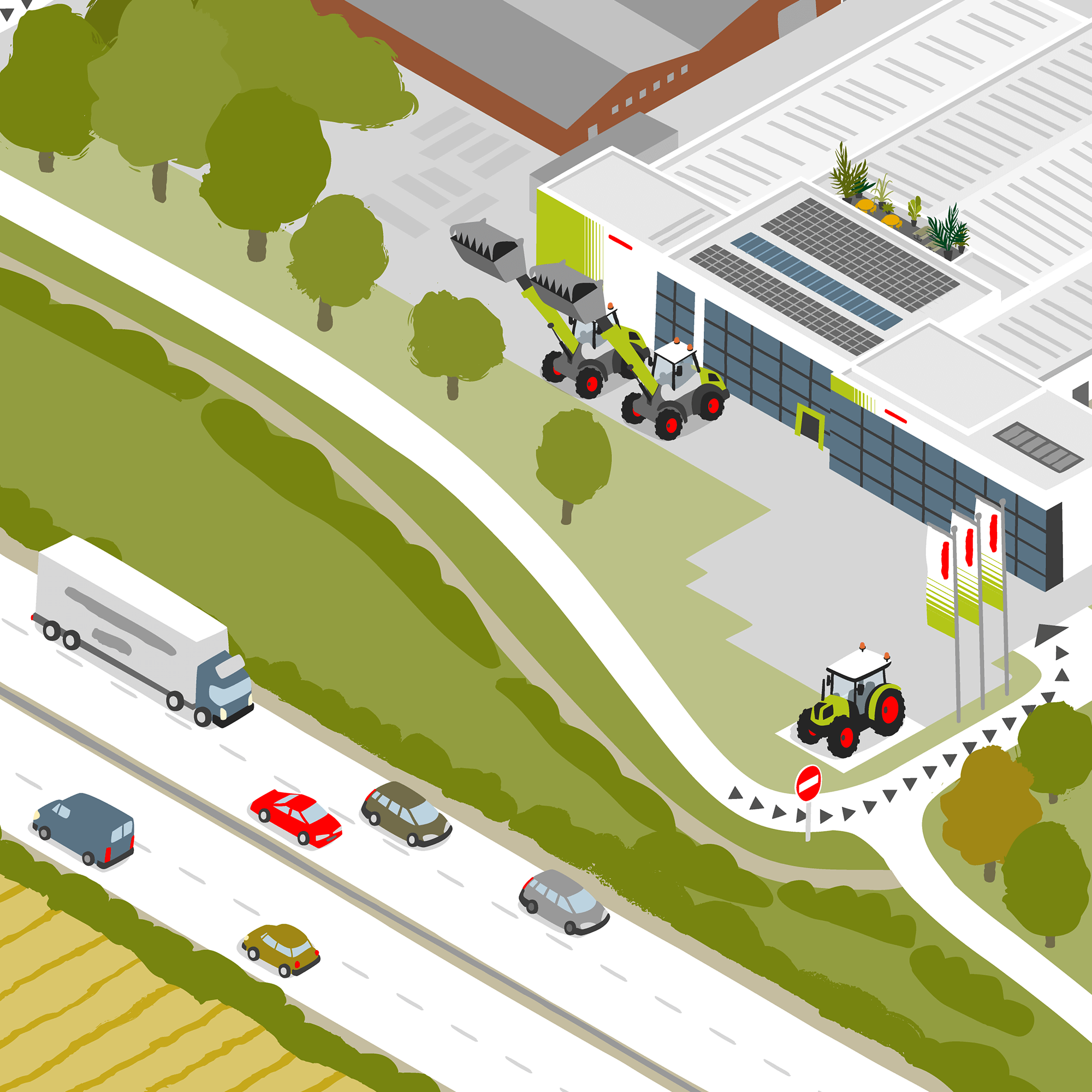
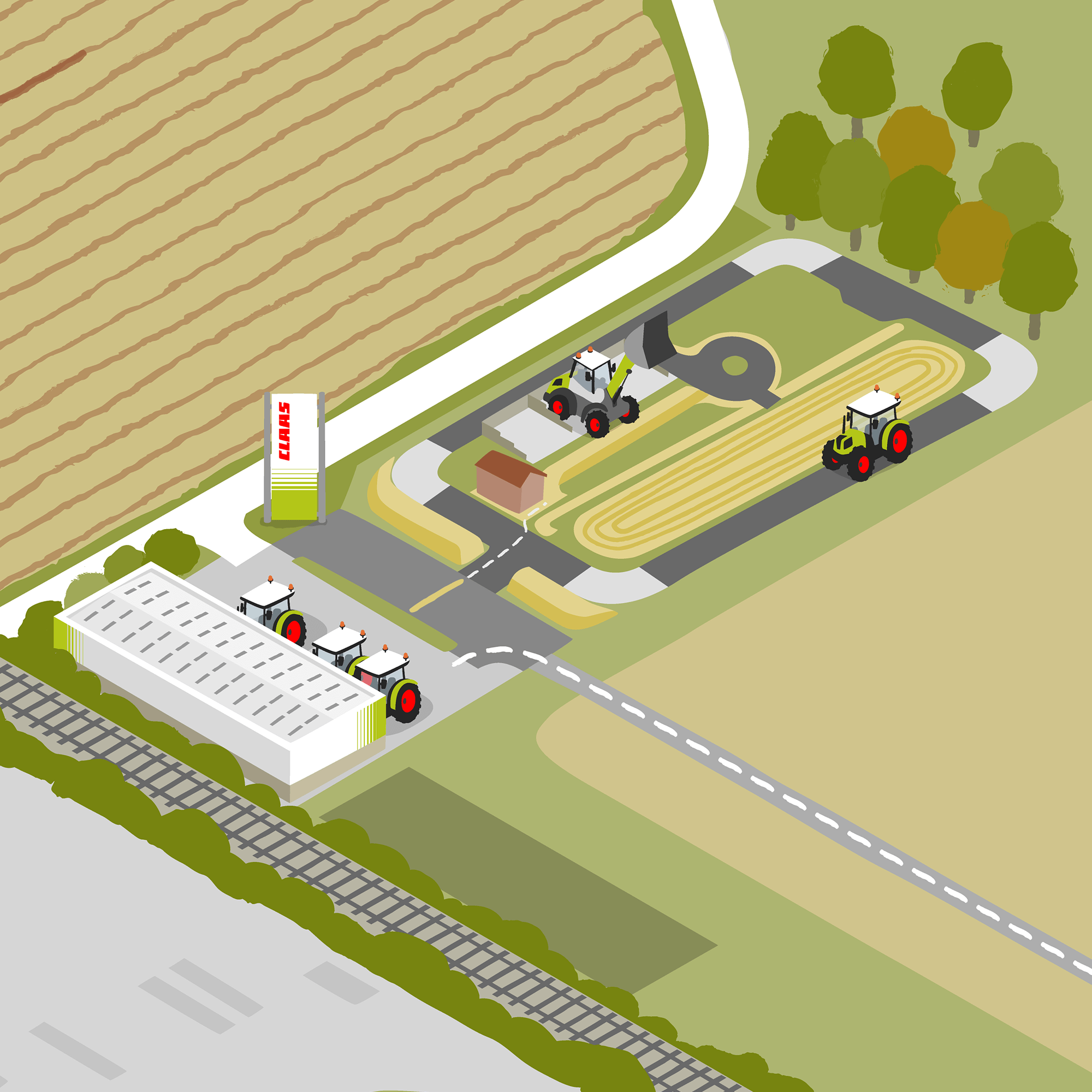
To help explain the geography of the site I opted to draw the map in an isometric/3D style.
I created the artwork in Adobe Illustrator using an isometric grid as a guide - it isn’t intended to be true 3D, more of a 3-dimensional feel applied to my style of illustration.
The isometric approach meant I needed to be fairly accurate in the way things are drawn so that all the elements fit together correctly and it feels like everything is in perspective. However, I didn’t want the artwork to feel too clinical, and so in drawing the various elements I have incorporated lines which might have a slight curve or ‘wonkiness’ and corners which are a little rounded - essentially so not everything is straight lines and sharp corners.
The final map, complete with key (click to enlarge)
A selection of the machines and vehicles I created to feature on the map
PROCESS
Initial Sketch of the site layout
One of the main challenges in creating this map was to make the site layout work as a composition within a standard screen/print format, whilst also ensuring the geography of the site made sense.
At the sketch stage I worked out what I felt would be the best angle for the map, using Google Earth as reference. The layout was made trickier in that the site isn’t really a self contained shape and that there are fairly large areas of empty fields.
I considered utilising the space for labelling, but it was decided that a numbered key would be the best way to identify areas into separate zones, rather than labelling directly on to the map.
CLIENT FEEDBACK
“Carys is a very talented illustrator who worked professionally and patiently with us to create a site location map. We were blown away by Carys ability to envisage the intended outcome before even we had and bringing that to life without ever visiting our headquarters. We look forward to working with Carys again on our next project.”
- Emily Bayliss, Customer Care Co-ordinator, CLAAS UK
RELATED PROJECTS

CATTLE COUNTRY FARM PARK | Illustrated Park Map

SOUTH KEN GREEN TRAIL | Logo & Illustrated trail map for Discover South Kensington